


Course Overview
The First Coast Head Race comprises a 3-mile course along two connected waterways, winding through three bridges, skirting beautiful marshes, and passing through several riverfront communities. It is a test of strategic planning, solid decision-making, endurance, and grit for rowers and coxswains.
Course Map
2025 FCHR Course (To be updated by October 2026
Course Videos
2026 Full Course Video
The NEW 2026 course video will be posted here on OCTOBER 8th.
2025 Full Course Video
Bridges Steering video
All coxswains and scullers are encouraged to watch the new “Steering the FCHR Bridges” video, which covers steering through the three bridges that they will encounter on the racecourse, with particular emphasis on steering between the University and Cesery Bridges.
Bridge Details
University Bridge to Cesery Bridge
Please refer to the two marked lanes that lead to the racing arches as shown on the map below. This is not a bridge to approach at an angle, so for safety, stay centered between the outside course buoys and the smaller navigational guide buoys. It is imperative that eights and fours/quads enter the Cesery Bridge arches pointed straight before they enter the bridge. The sharp inner turn requires more steering from the rowers, so we recommend the outer lane and span for inexperienced eights and/or coxswains.
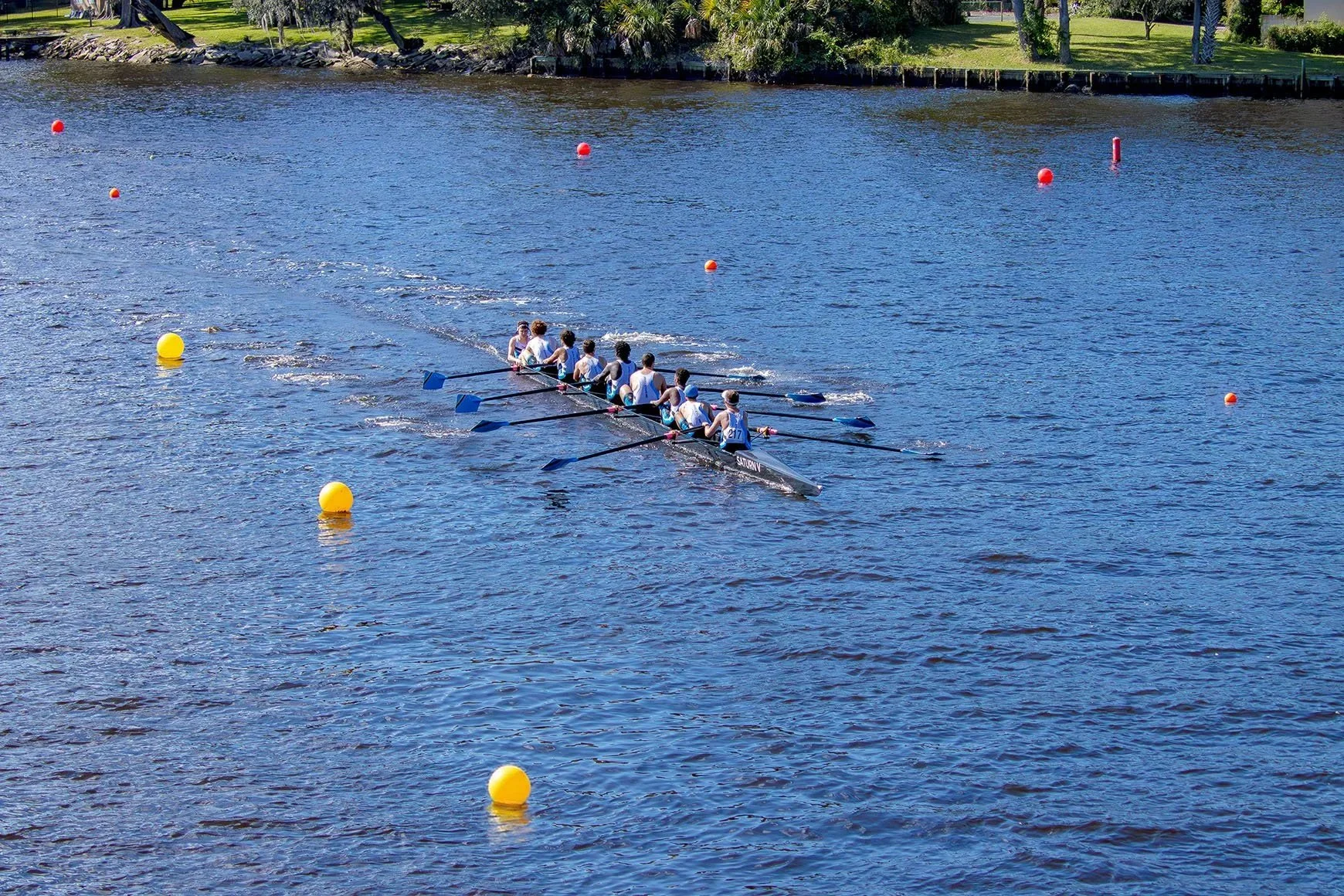
Crew rowing between University Bridge and Cesery Bridge, following the high-visibility course buoys and 9-inch orange guide buoys designating correct approach lanes for travel through the Cesery Bridge.
Bad Weather Shortened Course
In the event that high winds were to make for unsafe racing conditions in the less protected sections of the racecourse near the Start Line, the Start Line and the Staging Area will be moved such that we can conduct the races in safe, rowable conditions and that the course length can be as long as practical. As water conditions might change throughout the day, we may infrequently shorten or lengthen the course by moving the Start Line. The Start Line timing team will be located on a pontoon boat which can be moved as necessary. Masters age handicaps would be adjusted.
If the Start Line were moved such that the U15 and Middle School racecourse ending at the University Bridge would then be less than 1300m, the racecourse for U15 and Middle School events would be moved to start on the far side of the Cesery Blvd Bridge (the side closest to the Finish Line) and these races would then finish at the course's regular Finish Line. Those crews would pass through the Cesery Bridge on their way to their Start Line, but only at paddle pressure.
Google Earth Maps
To help you get familiar with the course and site layout, we encourage you to explore the Google Earth map of the site and course, showing the venue, course buoy layout for port, starboard, and guide lanes, and also the designated bridge spans you’ll be able to travel through.
To view in 3D mode: Click the “3D” button, then the button next to it with the compass needle to open heading and tilt controls.
NOTE: There are NO “slides” set up — just use the map and controls to explore.

